Walking the Thames-Down Link
I began walking around my country from my hometown. That’s Kingston-upon-Thames, no longer a town but one of the outer boroughs of Greater London. It’s a comfortable place and has a long history: Saxon kings were crowned here over a millennium ago. It remained an important crossing point over the lower River Thames and a separate centre until about 180 years ago, when built up settlement expanded along the recently built railways and Kingston became part of London’s vast urban sprawl.
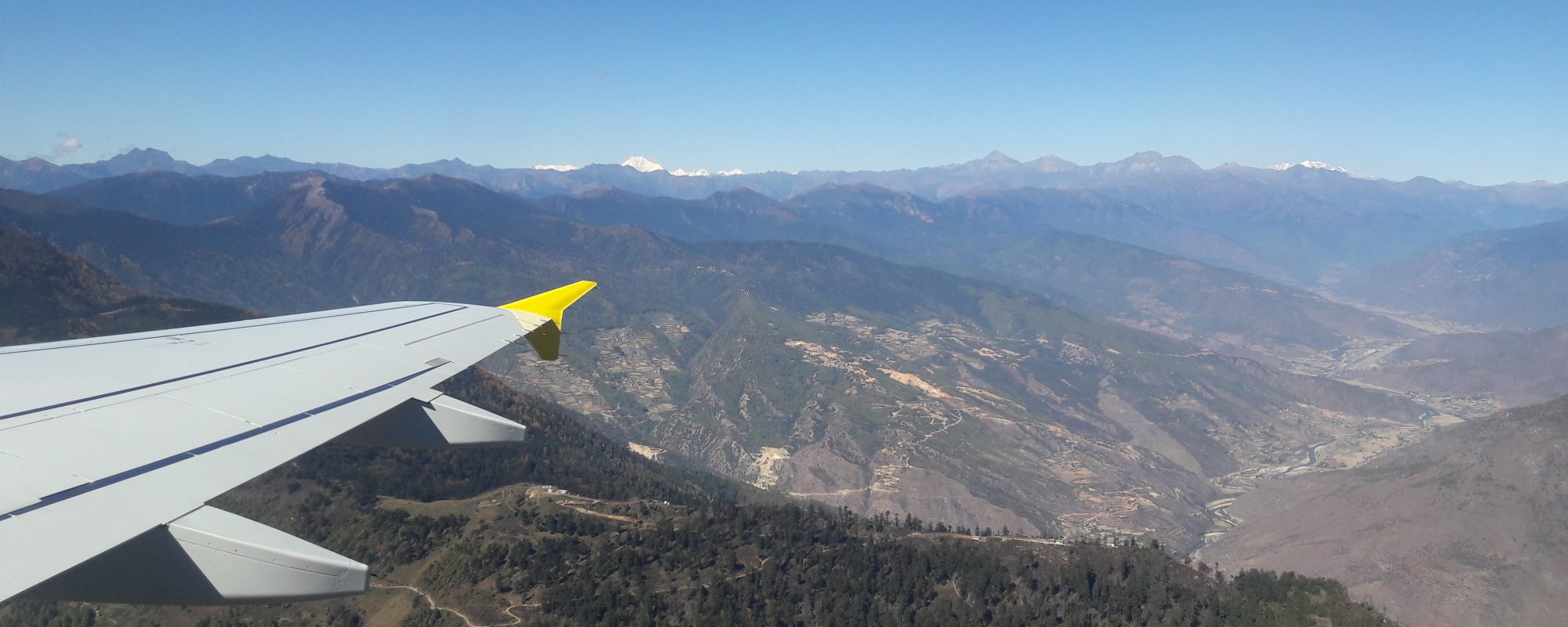
The main bridge over the River Thames at Kingston is the start of a long-distance path, the Thames Down Link, that leads from the River Thames to the North Downs. It’s a 16 mile walk from clay to chalk; from river valley to hills; and from suburbs through “exurbs” of Greater London to the countryside beyond.
The first part of the walk followed the Hogsmill, a tiny (six miles in total) tributary that joins the Thames at Kingston. For the first mile upstream, the stream was little more than a concrete drain that channels the water through Kingston’s mish mash of buildings: late Victorian terraces, twentieth century semis, and now 21st century multi-story blocks including Kingston University and its Art College. The channel had a narrow line of trees and bushes either side.
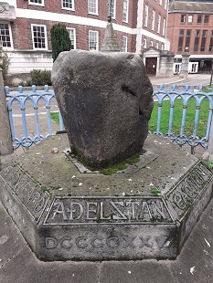
When I walked along the Link almost a year ago, I missed Kingston’s most historic monument, the Coronation Stone on which Saxon kings Athelstan and Ethelred were allegedly crowned. It sat just inside the grounds of the Guildhall within its own rather worn metal and concrete enclosure just after the start of the walk. For such a relic of Anglo-Saxon England, the stone deserves better. I think there are plans to move it to Kingston’s central marketplace but, as I write, it is still imprisoned at the Guildhall.
Two primary schools backed on to the route in central Kingston. Both were bounded by “V mesh fences”, rigid welded wire mesh fencing. The first was green – like many similar fences I’ve seen across mainland Europe – the second blue. The other side of the blue fence was a playground of artificial turf. The day I walked past, children were determinedly running around the perimeter of their playground encouraged by a teacher with a whistle. I think we had metal fences around the schools 50 years’ ago but not as high or as robust. I suppose the V mesh fencing is safer for today’s children and real grass might be more difficult to maintain.
A mile away from central Kingston, the route passed by the borough’s household recycling centre, where we deliver our bulk waste, and feel better about ourselves. The centre is adjacent to the “Hogsmill Clean Water Depot”, the local sewage works. You can see the extent of the site from the main railway line, which is elevated here. From the path, there was little to see except four large vats which gave off a loud humming. I didn’t smell anything, but at other times you can catch a strong whiff of sewage in the vicinity, a reminder of what we all produce in the comfort of “water closets”.
Walking upstream, the Hogsmill was no longer concreted, although it was still in a straightened channel. The margins gradually widened with reeds, bushes and trees either side. But before the green passageway opened out, there was a major barrier to negotiate – the A3 trunk road: a road of escape for us residents of South-West London, to take day trips in the Surrey, Sussex or Hampshire countryside.
The pathway left the stream and crossed underneath the road via a lit underpass. The bare concrete walls were clean, bar one graffito. It said: “Bitcoin is hope”.
I was so startled that I didn’t take a photograph, even though I had a camera and a smartphone with me and had resolved to take photos during my walk. Like the best slogans, it was simple and memorable. The words dogged my musings for the rest of the walk. But like other slogans, its brevity and certainty hid so much. There was no room for doubt about the value of cryptocurrencies, their moral hazard (or lack of), or the relative incomes gained from capital and labour. Perhaps it had been written by someone desperate to talk up the price of their flutter and who wanted to cash in their gains. They could have chosen a more prominent place.
The joys of green spaces
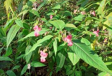
On the other side of the A3, the green ribbon of vegetation widened and thickened, and the Hogsmill had space to meander. I came across lots of Himalayan balsam, a bush that likes boggy ground and whose ripe seed pods explode with light pressure. It gave me childish delight to squeeze the seed heads. I know better now. It is an invasive species whose strong scent is particularly attractive to insects. It deprives indigenous plants from insect born pollination. I also saw a flash of a large bird with a brown and white chest, a hooked beak and roundish wings, probably a sparrowhawk and a rare sight in urban areas.
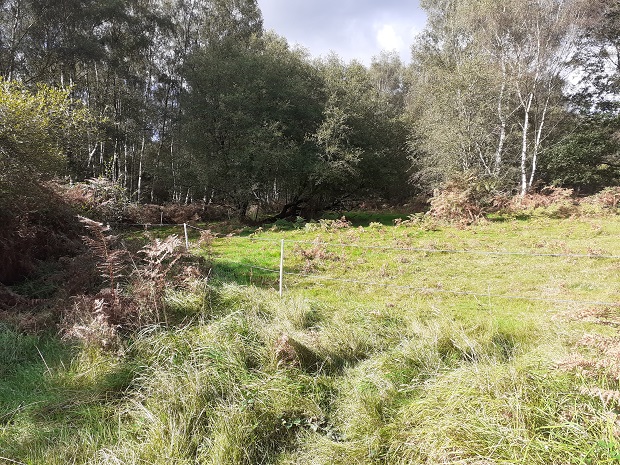
After crossing a road at traffic lights at the edge of Epsom (“Twinned with Chantilly” the road sign said – another town with a wonderful racecourse), the route left the Hogsmill to cross a series of large open spaces through which the path gradually rose imperceptibly towards the hills beyond. These spaces are part of the green belt round London. For all the debates about the need for more housing in Britain, we need to preserve them to temper the worst effects of heat and pollution in built-up areas.
The green spaces proved to be varied in origin and current use. In my travels around Europe, I can’t recall such spaces around the largest cities – but I may be wrong. The first was Tolworth Court Farm,“.. managed for quiet recreation and nature conservation”. This was an open, rather featureless space (albeit a good place to let a dog run loose). Next was a thin strip, the Castle Hill Local Nature Reserve some of which was under a line of pylons that were buzzing with electricity. Benches were set out for walkers to rest and enjoy the greenery and information boards on what wildlife might be seen there.
After a detour through housing, the Horton Country Park followed. Here fields were interspaced with dense thickets of bushes and trees. I saw a roe deer trotting along the edge of one open field, and soon after a field full of llamas grazing from feeders. Epsom Common was a bit wilder with some parts fenced off to help “restore the natural vegetation”. I wondered whether “natural” was pre-Roman iron age Britain or pre-industrial revolution. Ashtead Common had the smartest signs and paths – not surprising given it has been owned by the City of London Corporation since the 1870s. It is one a string of green spaces around London owned by the Corporation. I am glad the money men of the City of 150 years ago had such foresight.
The last green space was Ashtead Park. Unlike the others, it was more mixed with large houses scattered amongst green spaces. Most houses had large cars outside, imposing fences or pristine gardens, or a mix of all. One of the largest without fence or hedge had a large sign: “Private Property. No trespassing. 24 video surveillance”. Such directness was both jarring and fearful, but maybe the owners had suffered serial burglaries.
A Roman Road to the chalk hills
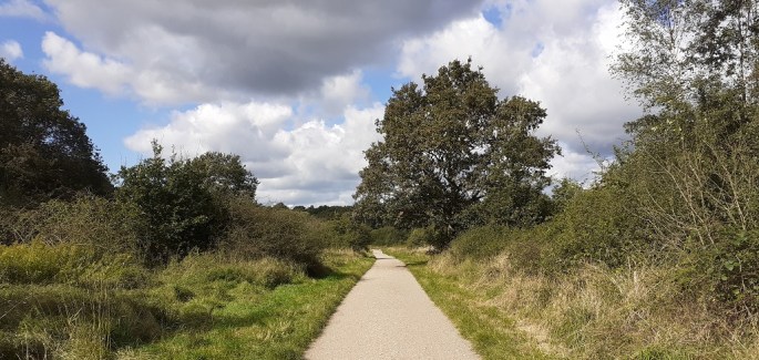
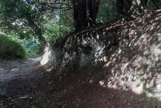
The path continued steadily uphill out of Ashtead Park, through Ashtead village and became a slippery track as the path had protruding bits of chalk. It then turned sharp right. This was the Stane Street, the ancient Roman road linking London and Chichester.
True to repute, the route was very straight, and went up and down the chalk slopes with no concession. I imagine that when the Romans constructed the road, it was a clearway through the ancient forest (or whatever vegetation was on the North Downs in the Iron Age). Today it is the reverse – the route is now a line of trees with a path running through it, with open land slightly below on either side.
The first main barrier on this part of Stane Street was a very modern road, the M25, London’s orbital motorway. The M25 was cut into the chalk hills here and the carriageways curved around the contours. There was relatively little traffic but enough for the roar of engines to be continuous. Thankfully, the roar was muffled by the extensive trees and bushes on both sides.
After about another mile along Stane Street, the path turned off to the right. The track was no longer built up and I lost sight of the open countryside. Instead, it was increasingly sunken into the chalk and in some places very slippery. This was the Mickleham Downs, and as there was little to see except the canopy of trees either side, my mind wondered back to Bitcoin as I plodded on.
Eventually, the path descended towards the Mole Valley, one of the main gaps in the North Downs. It was formed at the end of the Ice Age as meltwater cut through the chalk. The end point of the route joined the North Downs Way, a “national trail” which runs east-west along the hills and from which you have great views southwards to the Weald. I couldn’t find the precise point, but it is near Westhumble where there is a railway station from which I was going to catch a train home.
A group of middle-aged men arrived at the station shortly after me. They were speaking loudly to one another, and I guess they had had a good lunch out. One of them walked round the station building looking for something. He went behind the station building, looked around again and had a quick pee. He didn’t see me as he found relief – but then I was still in a Bitcoin trance.
The route
The Thames Down Link: there is a written guide of Surrey County Council (archived here) that is a bit out of date – the route on Google maps is slightly different at the start. The signage along the route is reasonable, but in Kingston don’t always point the right way, and I lost signs at Tolworth Court Farm and near the end around Mickleham.
I walked this in September 2021, so I don’t know if the Bitcoin graffito is still there.
